
Meeting point:
The meeting point will depend on the chosen itinerary and participants are staying, always suitable for the greatest possible comfort.
Meeting time:
The meeting time is also flexible depending on the diversity of the group, fitness levels and weather forecast.
The itinerary options are:
Gerber Waterfall: A valley hanging between Gerber and Bonaigua
The Gerber Waterfall, located saving the elevation difference between the Gerber and Bonaigua valleys, is situated in a glacial valley. During the itinerary, we will first get to the Estanhola of Gerber and, later, to the extraordinary Estany of Gerber, round shaped lake occupying the entire glacial over-excavation basin of the Gerber Cirque. The landscape is absolutely spectacular.
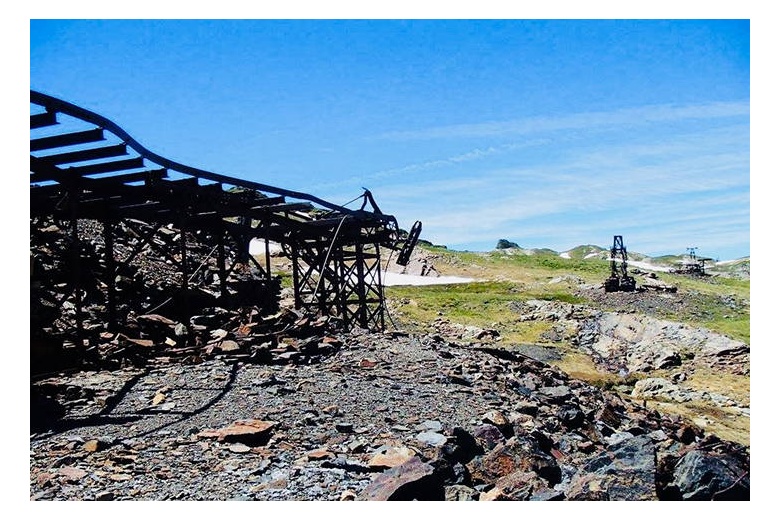
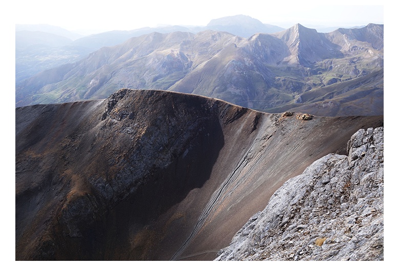
Victoria mines: Travel to the time mining
Being the only exploitation that is at relatively low levels, between 900m and 1300m altitude, it was exploited all year round, but they were still not exempt from cold or danger. Historically it has had many changes in concessions, workers from varied places, extractions of lead minerals (galena) and zinc (esfalerita), depending on the demand of the time. The opening and closing of this operation had a major impact both on the economy of the area and on the development of infrastructure as well as the implementation of electricity that not only served to boost mining, but also the inhabitants of Bossòst, benefited from such good innovation.
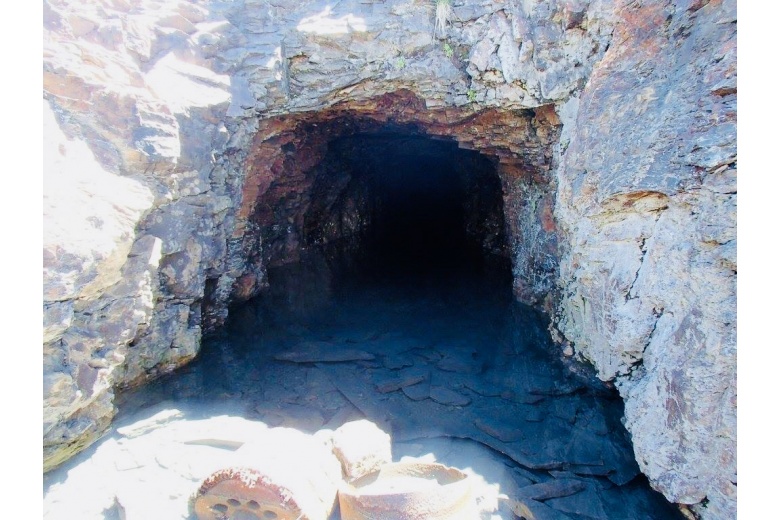
Liat: A mining walk on the time
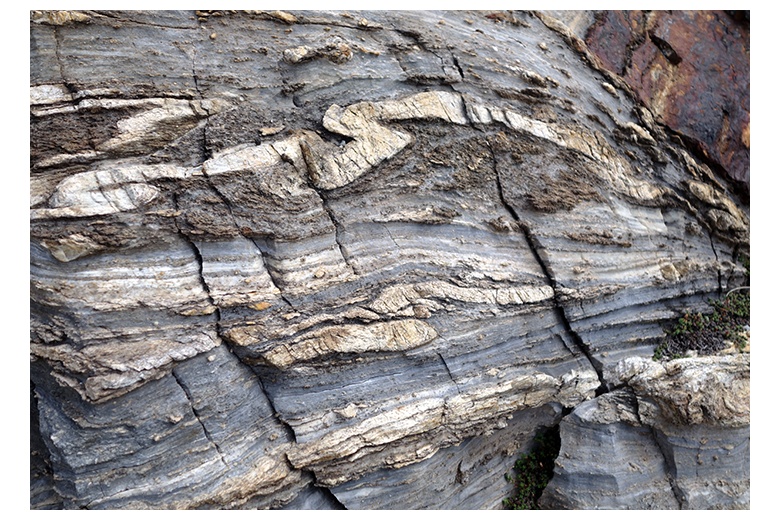
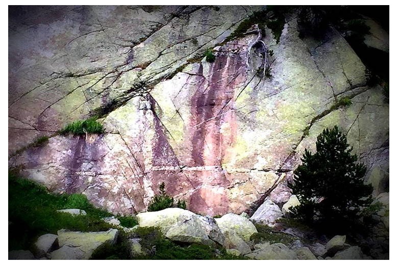
Through the Unhòla Valley and towards the lakes of Liat first, we will ascend till 2,300m altitude to find the abandoned mines of Liat exploited in the 20th century. We will enter one of the ores and we will tell everything related to the exploitation and extraction of minerals that was carried out then. We will also go through different rocky materials and explain their differences, plus everything about the spectacular landscape that surrounds us, the lakes of glacial origin, their geomorphology, the Calhaus waterfall, the goethite area and the meanders in the Unhòla river (red river) due to the presence of iron oxide. During the tour a geological explanation of how the Pyrenees and the visited site were formed will be given.
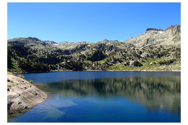
Valley of Ruda: Glacial Modelling
The ice has sculpted the land over the years and it is more tan evident in this valley. The fanciful figures carved on the rock are a clear sign. We will learn to detect those signs and interpret them correctly. On our tour we will pass through the most important source of the head of the Garona and through different forms of moraines and distinctive traits of glacial erosion to reach the Saboredo Cirque and be able to discern the “Aguja del Gendarme”, the limit of two pre-existing glacial cirques.
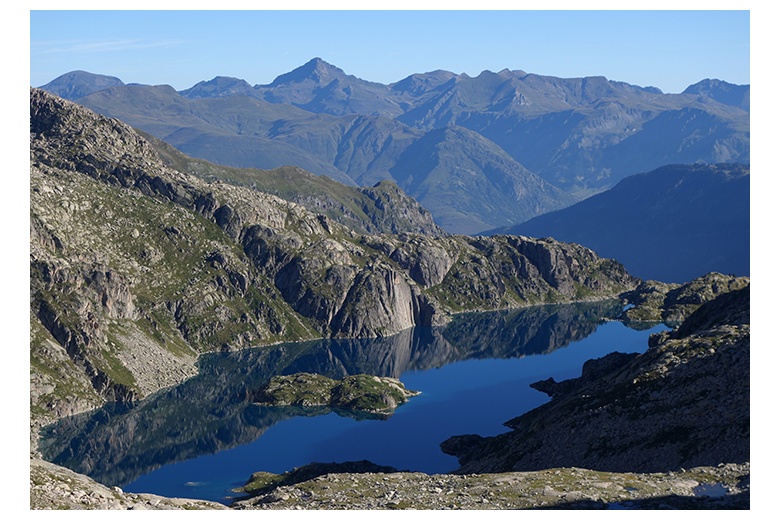
Colomers: Mirrors of water
The Colomers Cirque is found within the National Park of Aigüestortes and Lac de Sant Maurici. It includes around fifty lakes of glacial origin. Our itinerary will cover the seven most representative lakes of this peculiar place. We will observe the natural processes that have been remodelling this fascinating milieu, the composition of the rocks that we will cross, the active processes on some of the slopes, hydrology, fractures, characteristics of the Colomers dam and we will reveal an endless number of geological curiosities.
Included:
Not included:
General Information:
For the outdoor activity that you plan to be successful it is very important that it accommodates to your level, both physical and technical. Here we present some guidelines so that you can get an idea of what your level is according to the programs we propose. However, we recommend reaching to us so we can help you personally and adapt the program to your conditions.
The Geological Tourism has expanded since a few years thanks to the development of the geoparks and has enhanced the conservation and dissemination of the natural heritage of a region.
The proof and a perfect example is this initiative to bring together the great natural wealth of the Pyrenean Axial Zone by explaining and making detailed information in an understandable way without losing the scientific rigour. It is always supported by graphic material by virtue of these magnificent days surrounded by mountains of fantastic nature.
Thus, during these mountain itineraries, in addition to feel overwhelmed by the splendid surroundings and unequal landscapes, you will learn everything about the geological environments, processes and phenomena responsible for the landscapes, rocks, minerals and fossils formation that we will find.
It is a great pastime, very rewarding… the perfect way to spend the day with family or friends surrounded by extraordinary sceneries.