Day 1:
Meeting with the guide in Benasque to review the equipment needed and finalize the details for the following day.
Day 2:
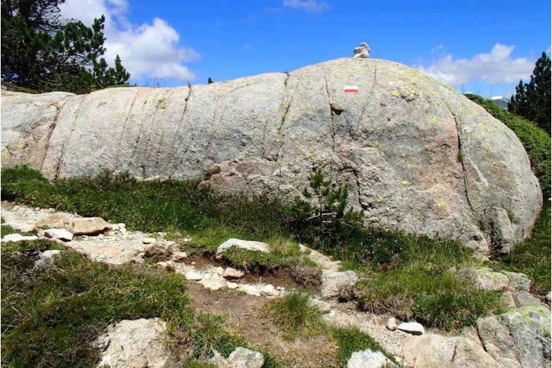
Early transfer to Plan de Besurta (1940m) – Plan de Aigualluts – Ibón de Barrancs – Colladeta – Collado de Salenques (2810m) – Margalida (3241m) – Tempestades (3290m) - Aneto (3404m)
Duration: 14-15h
Elevation gain/loss: + 1500m / - 1500m
Included:
- UIAGM / AEGM Mountain Guide services
- Advices prior the start of the route
- Reservations management services (in case of needed)
Not included:
- Transfer to the start of the route
- Accommodation before and after the activity day
- Snacks and/or drinks during the activity day of the participants and/or guide
- Extra expenses due to possible program variations of both participants and guide.
General Information:
- Each participant is required to possess an at date license issued by the Mountaineering Federation valid in the Pyrenees.
- Mountain climbing involves risks. Each member of this program takes full responsibility of what could happen.
- The mountain guide reserves the right to modify the program depending on weather conditions, group factor or any other cause that in his opinion may be decisive.
- Mountaineering boots
- Crampons
- 35l backpack
- Harness
- Helmet
- Headlight (charged batteries)
- Climbing landyard
- 2 screw-lock carabiners
- Gore-Tex jacket
- Primaloft jacket
- Thin fleece or Polartec
- Thermal t-shirt
- Softshell pants or similar
- Gaiters
- Sunglasses
- Cap
- Sun cream 50+
- Lip balm 50+
- ID
- Mountaineering Federation License at date valid for the Pyrenees
- Cash
- Mobile
For the outdoor activity that you plan to be successful it is very important that it accommodates to your level, both physical and technical. Here we present some guidelines so that you can get an idea of what your level is according to the programs we propose. However, we recommend reaching to us so we can help you personally and adapt the program to your conditions.
Alpinism & Climbing
TECHNICAL level
- 1 = No or very little experience in mountaineering. Has big expertise in trekking. Able to walk on varied terrain (snow or rock) with some simple easy climbs. Graduation ascents "F".
- 2 = Reduced experience on big mountains and mountaineering. Has accomplished some climbs with the use of ice axe and crampons on steep terrain. Has travelled across alpine glaciers. Has slight notion of climbing and progression on ridgelines. Graduation ascents "PD".
- 3 = Frequently on big mountains and mountaineering. Accomplishes periodic ascents with the use of ice axes and crampons on steep terrains. Manages the rope for belaying. Travels across alpine glaciers and snowy or icy slopes. Has some knowledge on rock climbing up to IV or Vº and progression on ridgelines. Graduation ascents "AD".
- 4 = Solid experience on big mountains and mountaineering. Has already performed alpine ascents and classic rock climbs of multiple pitches up to Vº or 6a. Is able to place gear to protect oneself. Masters rope work, belaying and rapelling. Has knowledge of snow and ice climbing techniques. Is familiar with the use of crampons and ice axes on icy or snowy slopes of more than 60º. Graduation ascents "D".
- 5 = Extensive background on big mountains and mountaineering. Has performed alpine mixed routes as well as classic multi-pitch rock climbs up to 6a or 6b. Is familiar placing and removing trad gear such as friends, stoppers, ice screws. Masters rope work, building belay and rappel anchors. Knows how to perform a bivouac shelter. Experience in high altitude (4000m or over). Accustomed to use crampons and ice axes on icy or snowy slopes of more than 80º. Graduation ascents "MD".
-
FITNESS LEVEL
- 1 = Completes easy hikes in the mountains of 3 or 4 hours long and 600 meters elevation gain carrying a light backpack of about 5 kg.
- 2 = Able to carry out itineraries from 4 to 6 hours long and 800 meters of elevation gain carrying a backpack of about 7 kg.
- 3 = Able to accomplish itineraries from 6 to 8 hours and 1000 meters elevation gain carrying a backpack of about 8 kg.
- 4 = Able to complete routes for 10 hours and up to 1200 meters elevation gain with a backpack of about 8 kg.
- 5 = Able to carry out long and hard routes of more than 12 hours and 1500 meters elevation gain carrying a heavy backpack of 10 kg or more.